Type something to search.. Water flows downward

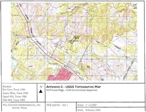
- The land parcel in question is the highest topographical point of the region.
- The Environmental survey shows water naturally drains towards the Travis Country West Neighborhood.
Proposed density with 55% impervious cover will risk flooding Travis Country West neighborhood.
Impervious Cover Subject to SOS Ordinance of 25% Net Maximum

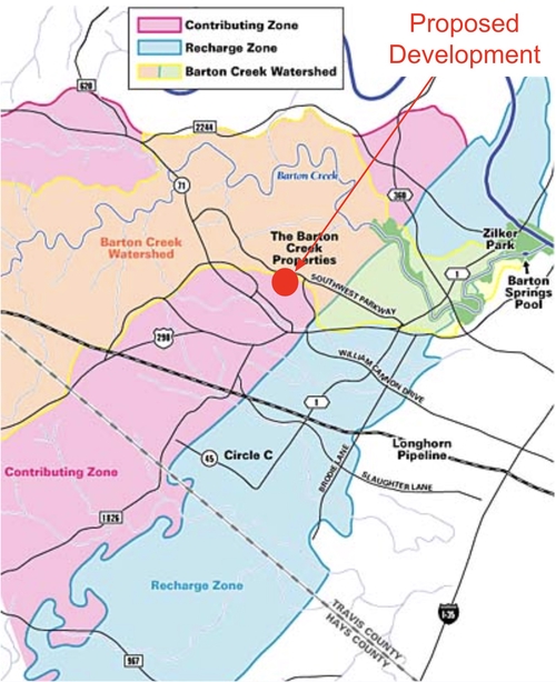
- The land parcel is located in the delicate ecosystem of this Edwards Aquifer Contributing Zone that serves as habitat for local wildlife and endangered species
- Located on a Hill Country Roadway with vistas among the highest points in the area with karst formations throughout
- The tract is subject to a 25% impervious cover limit based on Net Site Area (NSA) as per the current Save Our Springs Ordinance
- The Save Our Springs Ordinance was initiated by the citizens of Austin and enacted in 1992 to protect our springs from such environmentally harmful developments of this size, scope and density
- The Applicant has requested a restrictive covenant amendment that would be 220% the requirement of the Save Our Springs Ordinance.
- Across the street, the impervious cover limit is 20%, including a recently completed apartment complex (Saint June Apartments). Sunset Ridge would be 4.4x as dense as these recently completed apartments.
Any site development will need to comply with all current applicable laws and regulations including the Save Our Springs Ordinance.

